
Fairfax County has an imagery viewer that can help people understand the extent of the wetland in the past and provide context for marsh restoration.
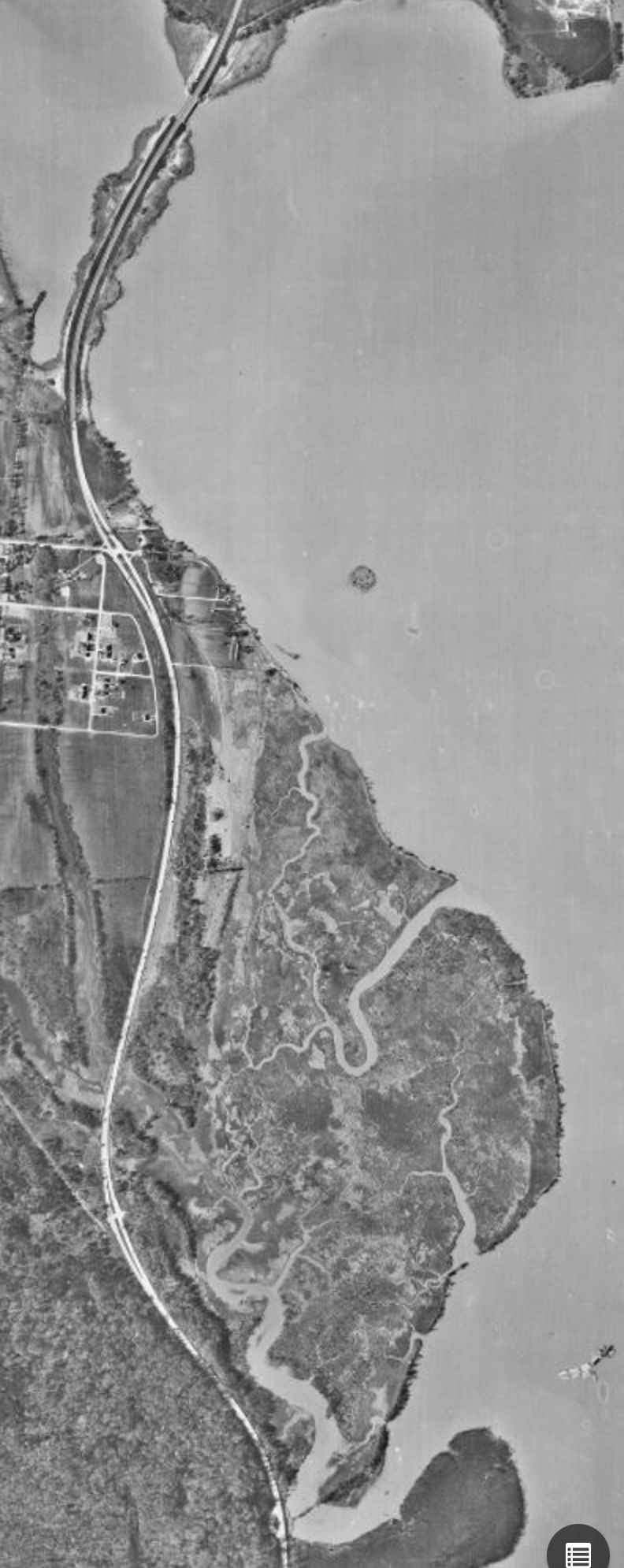
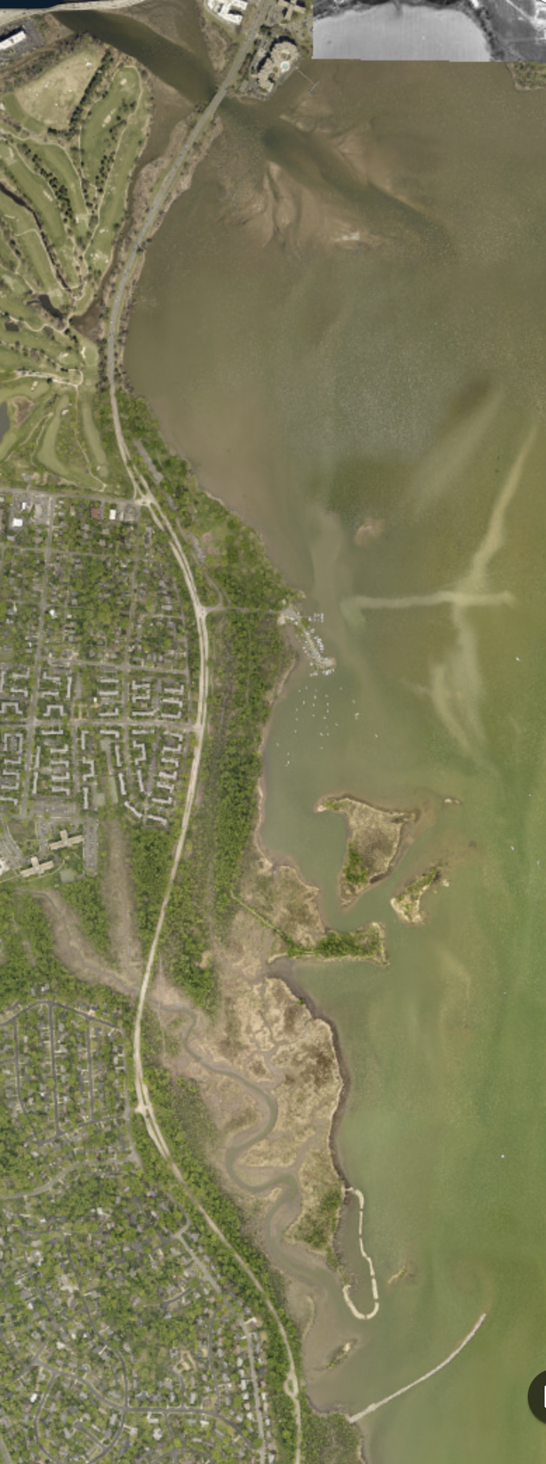
The two images below from the viewer show aerial views of Dyke Marsh in 1937 (left) and in 2021 (right). At the top you can see that the country club golf course was built on fill over what used to be water. At the very bottom you can see the natural promontory in the 1937 photo and the breakwater that replicates the former promontory removed by Smoot, Sand and Gravel. Between the top and bottom you can see the significant erosion that took place over the years. Two U.S. Geological Survey Studies found that the dredging destabilized the wetland system. See “Restoring the Marsh” on this site.
The Fairfax County site allows you to compare views of the marsh from many different years between the 1937 and 2021 dates. To view the map, click here. To view Dyke Marsh and see changes over the years, put "dyke marsh" in the search box and click to search. You can close the text boxes that block part of the view of the aerial map. Use one finger to move the map so that your screen has the area of Dyke Marsh that you wish to view. Use two fingers (very carefully) to zoom in or out on the map. Once you have the area on the screen that you wish to view over the years, click on "Layer List" icon at the bottom of the screen.
![]()
To start viewing different years against the latest map, make sure "2021 Aerial Photography" and one other year are checked. We suggest using "1937 Aerial Photography" as the second map. You may close the Parcels, County Border and Tax Map Grid layers to simplify your view. Close the layer list dropdown.
In the center of the screen should be a button with vertical lines. Click and hold down while you pull the box to the left to view the older map and to the right to view the newer map.
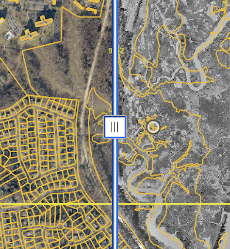
While in this view, you can click again on the layer list icon to change the two years you wish to compare. If the map does not change when you pull the arrow left and right, go to the "Swipe layer box" at the bottom, click on the down arrow and select the most recent of the two years you selected to view. You should then be able to see both images as you swipe.
If you live in Fairfax County and would like to try this in your neighborhood, go back to the first screen (you can exit and go back to the historic imagery viewer). Double click on the map for the location you are seeking to zoom in slowly and move the map until you see your neighborhood. This may take a little trial and error. Once you get there, you can change the layers and use the swipe function to see changes over the years.
Enjoy exploring!
We hope you found this article of interest. If you would like to comment on this article,